A Wae Rebo map looks harmless at first.
Seriously. You open it, zoom out, and see a small inland route branching away from the coast of Flores. A few bends. A thin line from Labuan Bajo heading into the mountains. Nothing dramatic. No red warning signs.
That was my first mistake.
I thought a Wae Rebo map was just about logistics. Distance. Travel time. Maybe road condition.
It turned out to be about something else entirely.
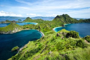
I was in Labuan Bajo when I searched it, sitting on a wooden bench facing the harbor. Boats were preparing for trips around Komodo National Park. People were talking about snorkeling, manta rays, sunsets.
Mountains weren’t part of the conversation.
And yet, that quiet inland route on the Wae Rebo map kept pulling my attention away from the sea.
From Screen to Steering Wheel
If you’re figuring out how to get to Wae Rebo from Labuan Bajo, the practical outline is simple: drive about four to five hours toward Denge Village. After that, hike for two to three hours uphill.
That’s the summary version.
The lived version is different.
The drive begins with coastal views and open skies. Gradually, the road narrows. Asphalt gives way to uneven patches. You pass small villages where children wave casually, not dramatically, just out of habit.
At some point, you realize the air feels cooler. Not cold. Just lighter.
The Wae Rebo map shows the road winding through hills, but it doesn’t show the way your body subtly adjusts to the curves. Or how conversations inside the car fade as everyone starts staring out the window.
There’s a shift happening, even before the trek begins.
Where the Road Ends
Denge Village is where vehicles stop.
The Wae Rebo map transitions from a driving route to a narrow trail. On screen, it’s just a faint line cutting through green. In reality, it’s a steady climb through forest that feels both welcoming and indifferent.
The first twenty minutes feel manageable. Then your breathing deepens. Sweat gathers at your temples. The ground tilts upward without apology.
I remember checking the Wae Rebo map halfway up, out of reflex. No signal. The app froze. That small digital reassurance disappeared.
For a brief second, I felt exposed.
Our guide didn’t hesitate. He adjusted the strap on his bag and kept moving, as if the mountain itself had already confirmed the route.
Maps require connectivity. Trails require trust.
The Moment the Village Appears
There’s no grand entrance sign.
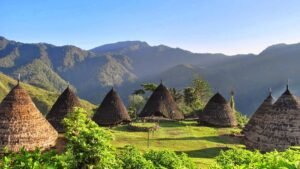
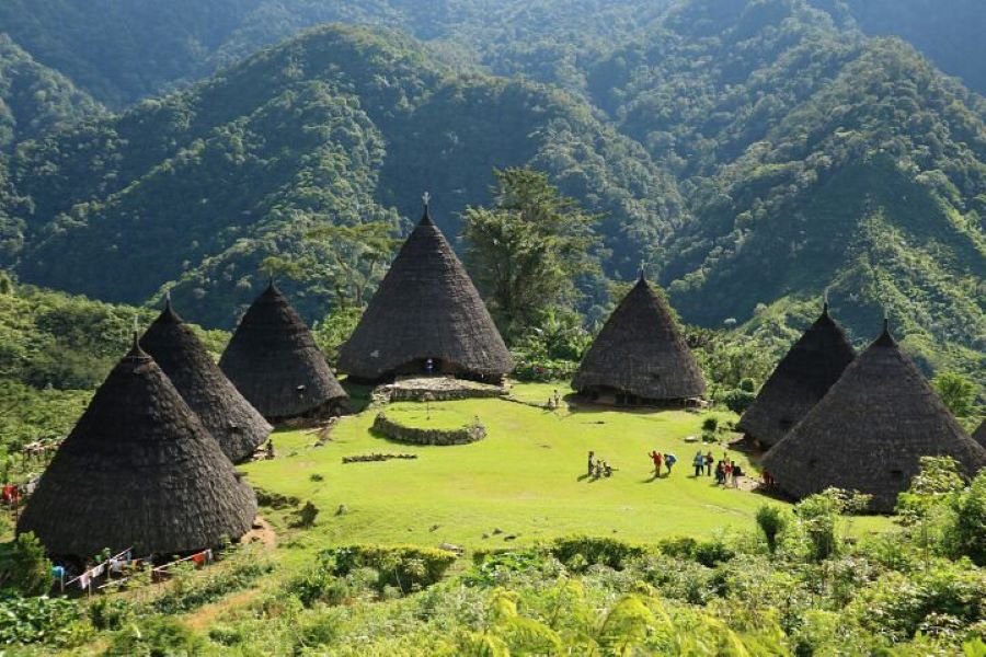
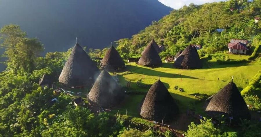
You round a bend. The trees thin. And suddenly, there it is: a circular clearing with seven tall, cone-shaped houses rising from the earth.
Mbaru Niang.
I had seen photos before. I thought I knew what to expect. But the first real glimpse hits differently.
Maybe it’s the altitude—about 1,100 meters above sea level. Maybe it’s the effort it took to reach that point. Or maybe it’s just the quiet symmetry of the houses arranged in a circle, smoke drifting gently upward.
No Wae Rebo map prepares you for that pause.
You don’t say anything at first. You just stand there, catching your breath, pretending you’re not slightly emotional over architecture.
It’s strange what effort does to perception.
A Living Village, Not a Display
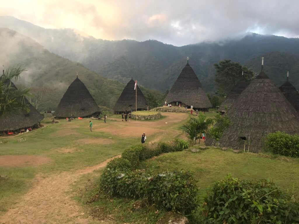
Wae Rebo isn’t a museum. It’s a functioning community. Families live inside those tall structures. Meals are cooked over open fires. Conversations happen in low, steady tones.
When visitors arrive, there’s a welcoming ritual. You’re formally received before staying overnight. There’s a contribution fee, part of a system that supports the village.
This is where cultural heritage conservation becomes tangible.
It’s not an abstract policy. It’s daily practice. The traditional houses have been rebuilt using ancestral methods. The structure of communal life remains intact.
And here’s the subtle tension: every Wae Rebo map shared online increases visibility. More travelers become curious. More footsteps climb the trail.
Tourism supports preservation. But it also changes the atmosphere, even if slightly.
That balance is delicate. You can feel it, though nobody announces it.
Contrasts That Stay With You
If you’ve been sailing Labuan Bajo before heading inland, the contrast feels almost cinematic. One day you’re surrounded by endless blue water. The next, you’re wrapped in mountain mist.
The coast feels expansive. The highlands feel enclosed—but not in a suffocating way. More like being held.
At night in Wae Rebo, the temperature drops quickly. Inside a Mbaru Niang house, a central fire provides warmth. The light flickers against wooden beams. Shadows stretch upward into the conical ceiling.
There’s no strong signal. No constant notifications.
Just the sound of firewood cracking.
It’s funny how quickly you forget about the Wae Rebo map once you’re sitting there on woven mats, sharing tea.
Coordinates stop mattering.
The Descent and the Return
The next morning, descending the trail feels faster. Your legs might disagree, but gravity helps. The forest seems less mysterious in daylight.
Signal returns gradually. Notifications flood your screen. The Wae Rebo map reloads, marking the path as completed.
It looks so small.
Back in Labuan Bajo, the harbor buzzes again. Tourists negotiate boat prices. Cafés hum with background music. Life resumes its coastal rhythm.
And you carry a quieter tempo inside you.
That’s the part no Wae Rebo map shows—the internal shift.
Practical Thoughts Before You Go
Weather changes quickly in the mountains. Rain makes the trail slippery. Good footwear is not optional, no matter how optimistic you feel.
Bring cash. There are no ATMs up there. Electricity is limited. Internet is unreliable.
Plan extra time. Don’t wedge the trip between a tight sailing Labuan Bajo schedule and a same-day flight. Wae Rebo unfolds slowly. If you rush it, you’ll feel slightly out of sync.
And maybe that’s the key.
When the Line on the Map Means More Than Distance
Weeks later, I opened the Wae Rebo map again—not because I needed directions, but because I wanted to revisit the route visually.
From Labuan Bajo. Through winding hills. Up to that quiet circle above the clouds.
It looked like such a small detour on the island.
But it didn’t feel small.
Because the journey wasn’t just about how to get to Wae Rebo from Labuan Bajo. It wasn’t even about ticking off a destination.
It was about climbing into a place where cultural heritage conservation isn’t a slogan—it’s visible in timber, thatch, ritual, and routine. A place slightly harder to reach, and therefore slightly more intentional.
So yes, use a Wae Rebo map. Study it. Prepare. Respect the process.
But once you start walking, let the line on the screen fade into the background.
The mountain will take over from there.